データセット詳細 / Details of the dataset
- ID
- 015019201600
- データセット名
Dataset Name 阿蘇火山仙酔峡域SfMデータセット
Sensuikyo area, Aso volcano, SfM dataset
- 画像
Images -
- 提供機関
Vendor 地形鮮明化プロジェクト事務局
HD Topography Project
- 概要
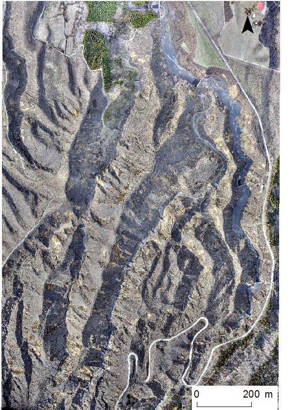
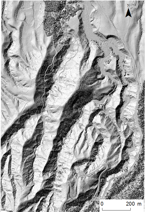
Description 阿蘇火山仙酔峡域において、UASとSfM-MVSによって計測された、オルソ画像とDSMです。
Orthorectified images and DSMs measured by UAS and SfM-MVS photogrammetry.
撮影時期:2016年3月、2016年5月
ファイルタイプ:GeoTiff
空間解像度:0.2 m
座標系:平面直角座標系第2系(JGD2000)/EPSG: 2444
文献:
Saito, H., Uchiyama, S., Hayakawa Y. S. and Obanawa, H. 2018.
Landslides triggered by an earthquake and heavy rainfalls at Aso
volcano, Japan, detected by UAS and SfM-MVS photogrammetry. Progress
in Earth and Planetary Science 5, 15 (doi:10.1186/s40645-018-0169-6).
==利用条件==
- 論文、学会発表等による成果公表の際は、上記Saito et al. (2018, PEPS) を必ず引用してください。
- 公表した成果物(論文、学会発表要旨等)は必ずJoRASにて情報登録をしてください。
- データは再配布できません。
Time of acquisition: March 2016, May 2016
File type: GeoTiff
Spatial resolution: 0.2 m
Spatial reference: Japan Plane Rectangle zone 2 (JGD2000) / EPSG:2444
Citation:
Saito, H., Uchiyama, S., Hayakawa Y. S. and Obanawa, H. 2018.
Landslides triggered by an earthquake and heavy rainfalls at Aso
volcano, Japan, detected by UAS and SfM-MVS photogrammetry. Progress
in Earth and Planetary Science 5, 15 (doi:10.1186/s40645-018-0169-6).
==TERM OF USE==
- Please show the citation to the reference above (Saito et al. 2018 PEPS) when the research is presented either by paper submission or conference presentation.
- Please register the information about your research presentations (including papers and conference presentations) to JoRAS.
- The data cannot be redistributed.
データ一覧 / Data list
実施中プロジェクト / Active projects
地球科学分野の高等教育における効果的なオンライン学修環境構築に関する研究
Study on construction of effective remote learning environment in the geoscience field at higher education
住宅密集地の持続可能性に関する研究 -長崎の斜面住宅地を対象として-
Study on Sustainability of Densely Built-up Areas -Case Study of Hilly Residential Areas in Nagasaki